Desoto Mine

Desoto Mine

Details

Easiest way to get there is thru Mayer, AZ. off Hyw 69 to Prescott.

Where is a Circle-K in Mayer. From the Circle-K take Central to a left on Miami. From Miami take a right on Main St. Just past the Double D Bar on Main St., take a left on Wilks. At the three way junction at the end of Wilks, take Jefferson, which is the Goodwin Road.

The Goodwin Road intersects the Senator Hyw about half way between Prescott and CK. It’s about 25 miles of dirt road.

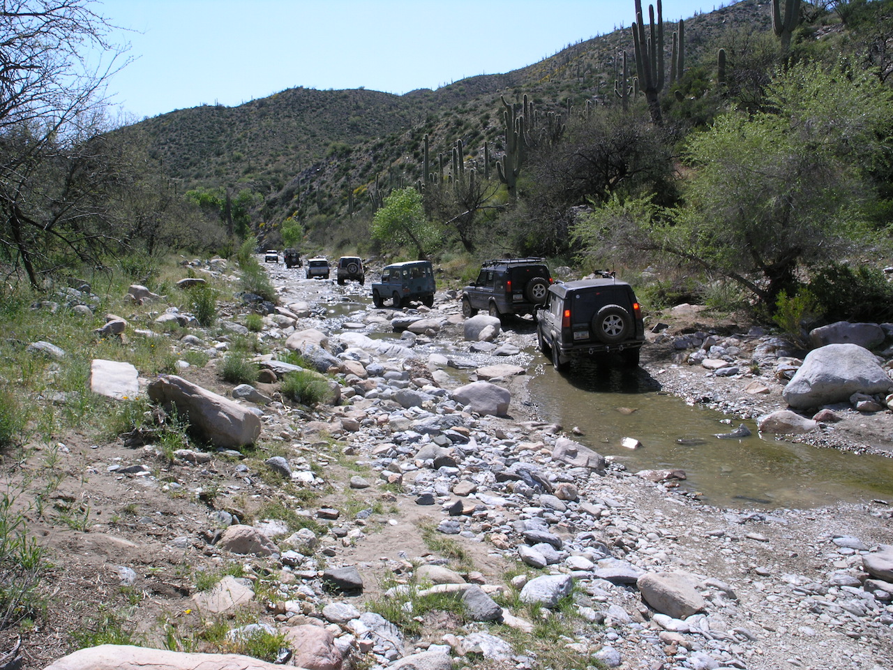
Take a left onto Senator Hyw, stay on it for approx 4 miles and turn left onto FS 89. It goes thru a burned off area, decends a hill and crosses a large wash. Turn left into the wash and have a good time! Once thru the rocky sections, both of which are relatively short, you climb over a ridge or two until you get to the next major wash at the Goat Ranch. From there, the trail goes up the the Peck Mine Road. This appears to be the main road, but the DeSoto trail is a very sharp turn to the left. If you cont. out to the Peck Mine you intersect the main road to CK and miss all the hill climbs and the mine itself.

There are two cattle ponds on this section. They probably have water in’m. Prior to the second pond you have the option of going out via the “official” route in Charles Well’s book, or heading up to the DeSoto Mine. There is a faint left turn off the main trail prior to the pond – that leads to some VERY VERY interesting off camber sections. I had my wheelin’ buddy hang off the high side as a counter weight thru one spot- the body roll made it feel alot worse than it is, but looking out the drivers door down 45 deg angle at steep hillside always gives me the puckers

If you proceed on to the pond itself, the trail goes up and over the top of the ridge. The route can be very confusing at this point due to a bunch of mine roads branching off the main road. Stop at the top and explore, it offers some great veiws. The main mine is to your right on top of the hill. Once you cross the top, the trail leads down to a large flat section and the main road is bunkered off. If you look to the left edge of the brush on the flat section, you will find a steep decent down to a mine shaft- that is the way out of the maze. Follow that road out to the CK road – you come out above Cleator by a few miles.

If you have the time and want to see some more neat country, take a left at Cleator on the old railroad bed cut just east of the Cleator Bar. It will take you back to Mayer once it intersects the Old Cordes road.

Lots of varied terrain with great veiws and a ton of history. You pass close to one of the more famous Apache vs. Miner fights in the old west. Battle Flat is a great story of survival and outright toughness.

Location

Address:
Wickenberg, United States
Continue Reading

Montana Mountain

Details

The route starts out in the low desert and continues into the upper elevations of the Superstition Mountains where it tops out at about 5200 feet above sea level. The higher elevations are on the northern slopes and offer the piney vegetation typical throughout the southwest. The climb to the elevations occurs along a series of switch backs that allows an impressive view of surrounding countryside. Stock vehicles with high ground clearance and good articulation can make it although some driving skill is necessary.

Location

Address:
Apache Junction, 85623, United States
Continue Reading

El Oso Mine Road

Details

Four Peak, south of Hwy87 from FR143

The Four Peaks area and the El Oso Mine trail is a great place to explore within a short drive from Phoenix. I wanted to lead a trail for the 4x4wire Arizona Isuzu and Mitsubishi group, and felt that this trail would make the perfect introduction. We met at the start of the El Oso (four peaks) road, with everyone showing up at about 9:30. We made introductions and started to air down in preparation for the 18 mile drive on the graded road (designated FR143). This area is popular for all OHV users, so quads and trail bikes are to be expected, especially close to the highway.

Climb in elevation in the Mazatzal Mountains on FR143. This road eventually ends at Punkin Center NW of Theodore Roosevelt Lake. The trail rises to over 5,000′ and reaches a saddle at Pine Mountain. This is where FR422 (Edwards Trail) heads north leaving FR143. This road is still tame and has a few steep climbs, but traction is good. At FR463 (N33 44.741 W111 22.175 NAD83) we left the main the El Oso mine trail (FR422) and start on the Joline Mine trail. This is where all of the challenges are encountered.

Within a few hundred yards of FR463, the trail yields some challenges, including some nice slabs that will test the suspension travel of the vehicle. This portion of the trail runs along a ridge overlooking Big Pine Flat, with some nice views. This area was damaged by fire many years ago, and is now just recovering. The brush here is very tight, and is the worst you will find throughout the loop.

Location

Address:
Fort McDowell, United States
Continue Reading

Patagonia Ghost Town Tour

Details

Location

Address:
Patagonia, United States
Continue Reading

Mount Graham

Details

Forrest Service graded roads to access camping areas.

Location

Address:
Sanford, United States
Continue Reading

Broken Arrow

Details

This trail combines the astounding Sedona beauty with moderate to challenging difficulty. The Red Rock country is the backdrop for this expedition that includes sights named Submarine Rock, Chicken Point, the Roundabout, and Devils Kitchen, with the challenge of slick-rock obstacles.


While relatively short in terms of distance, this trail calls for slow driving due to its tightness and rocky terrain. Many places are challenging because the driver needs to be well aware of their vehicle spatially and how to manage it over slick-rock, so drivers should have some experience.


The stock Range Rover, Discovery (including LR3), and Defender are well equipped to deliver a fantastic day.

Location

Address:
799 morgan rd, Sedona, Arizona, 86336, United States
Continue Reading

Mount Lemmon

Details

Back road to (north side) Mt. Lemmon is graded dirt road. The south side is paved winding road. Very scenic drive.

Location

Address:
Phoenix, United States
Continue Reading

Various Trails

Details

Venue Website:

Location

Address:
2797 E Ajo Way, Tucson, 85713, United States
Continue Reading

Hackberry Creek

Details

This trail follows a narrow valley surrounded by interesting rock formations. Very enjoyable hard-core run. Lockers and very high ground clearance recommended. A stock vehicle is certain to get damage. Getting stuck in mud is a real possibility if there has been lots of rain. The trail is rated both difficult and very difficult because there is a separate run that concentrates on the extreme portions of the trail that should be avoided by everybody except the most experienced/equipped drivers.

Location

Address:
Gold Canyon, United States
Continue Reading

Dripping Springs

Details

According to the Charles Wells book, ‘this trail starts easy and gradually worsens. The last mile before Dripping Springs is challenging and requires some backroad driving experience.’ Trail #60 in his book for more details.

Location

Address:
Winkleman, United States
Continue Reading